⬡Biodiversity Checker
A Peachester State School BioGlow FLL project. Queensland Ecologists advised the project and sponsors its technology.
966 Peachester Road Peachester QLD
Keep a copy
Send me this report
01/NATURE SIGNALS
Nature Signals - From your property
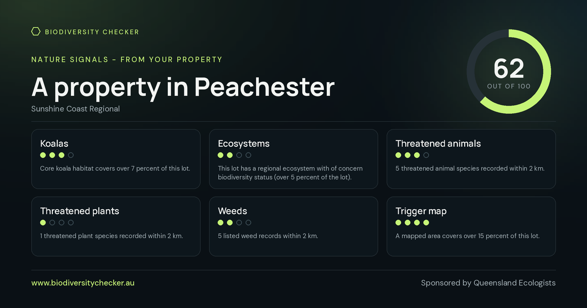
Based on what is mapped on this lot and recorded within 2 km. Adding your own sightings to iNaturalist raises it.
Koalas
Core koala habitat covers over 7 percent of this lot.
Ecosystems
This lot has a regional ecosystem with of concern biodiversity status (over 5 percent of the lot).
Threatened animals
5 threatened animal species recorded within 2 km.
Threatened plants
1 threatened plant species recorded within 2 km.
Weeds
5 listed weed records within 2 km.
Trigger map
A mapped area covers over 15 percent of this lot.
How the score works
Each of the six tiles above scores 0 to 4. The six scores are added together (0 to 24 in total) and scaled to a score out of 100.
Koalas scores 0 when no koala plan mapping and no records within 2 km; 1 when inside the koala priority area, habitat clipping an edge of the lot, or records within 2 km; 2 when locally refined koala habitat over part of the lot; 3 when locally refined habitat over most of the lot, or core habitat over part of it; and 4 when core koala habitat over most of the lot.
Ecosystems scores 0 when no regional ecosystem mapped on the lot; 1 when a least concern regional ecosystem only; 2 when a regional ecosystem of concern; 3 when an endangered regional ecosystem; and 4 when an endangered regional ecosystem and more than one mapped.
Threatened animals scores 0 when none recorded within 2 km; 1 when 1 or 2 recorded within 2 km; 2 when 3 or 4 recorded within 2 km; 3 when 5 to 7 recorded within 2 km; and 4 when 8 or more recorded within 2 km.
Threatened plants scores 0 when none recorded within 2 km; 1 when 1 or 2 recorded within 2 km; 2 when 3 or 4 recorded within 2 km; 3 when 5 to 7 recorded within 2 km; and 4 when 8 or more recorded within 2 km.
Weeds scores 0 when 13 or more listed weeds recorded within 2 km; 1 when 8 to 12 listed weeds within 2 km; 2 when 4 to 7 listed weeds within 2 km; 3 when 1 to 3 listed weeds within 2 km; and 4 when no listed weeds within 2 km.
Trigger map scores 0 when not on the map and nothing within 2 km; 1 when a mapped area within 2 km; 2 when a mapped area within 1 km; 3 when a mapped area within 500 m; and 4 when on the flora survey trigger map.
02/YOUR PLACE
Your place
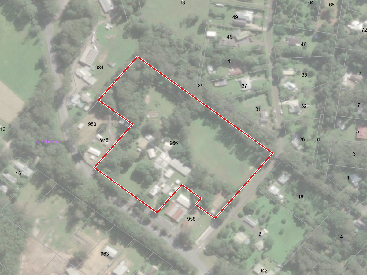
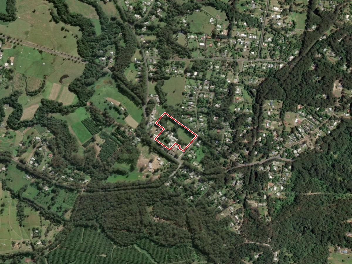
03/MAP
Explore the map
Drag to pan, scroll to zoom, and switch layers on and off in the panel at the top right. Each layer names where it came from. The map opens on your lot with about 2 km of the surrounding district in view. The dots are threatened species records within 5 km from the Atlas of Living Australia. A record of a sensitive species is drawn as a large faint circle, because the Atlas blurs where it was seen.
The interactive map needs JavaScript and the Leaflet mapping library. The maps further up this report show the same lot and district as pictures.
The interactive map is on the web version of this report.
What is on the map
- Aerial imagery (base map). Queensland Government aerial imagery basemap (Spatial Imagery Subscription Plan).
- Topographic map (base map). Queensland Government QldMap Topo basemap.
- Plain map (base map). Queensland Government QldBase Colour basemap.
- Your lot boundary. Queensland Government digital cadastral database (Land Parcel Property Framework).
- Koala habitat and priority area (4 mapped). Queensland Government Koala Plan mapping (South East Queensland Koala Conservation Strategy).
- Waterways and wetlands (19 mapped). Queensland Government drainage, wetland and wetland protection mapping (Water and Wetland Biodiversity, Wetlands, Wetland Protection, Vegetation Management).
- Threatened species records within 5 km (500 mapped). Atlas of Living Australia.
- Nearest Landcare groups (3 mapped). Queensland Water and Land Carers register.
04/ECOSYSTEMS
Ecosystems on and around the property
A regional ecosystem is a vegetation community tied to a particular landform and soil. Queensland maps them across the whole state and gives each one a code. The codes printed on the map below are the ecosystems mapped on and around this lot.
2 regional ecosystem codes are mapped on this lot.
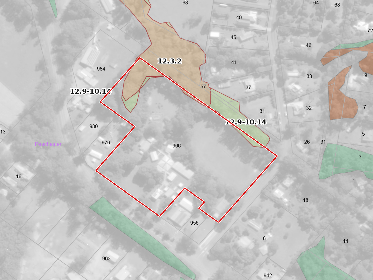
 Category C or R area containing of concern
 Category C or R area that is of least concern
 Non-remnant (unshaded on the map)
RE 12.3.2 Eucalyptus grandis tall open forest on alluvial plains
Why it matters: 12.3.2: Habitat for threatened plant species including Marsdenia longiloba and near threatened species including Diteilis simmondsii. This ecosystem is known to provide suitable habitat for koalas (Phascolarctos cinereus).
RE 12.9-10.14 Eucalyptus pilularis tall open forest on sedimentary rocks
Why it matters: 12.9-10.14: Potential habitat for NCA listed species: Acacia attenuata, Boronia rivularis, Caustis blakei subsp. macrantha, Eucalyptus taurina, Leptospermum luehmannii, Phaius australis and Zieria bifida. This ecosystem is known to provide suitable habitat for koalas (Phascolarctos cinereus). 12.9-10.14a: This ecosystem is known to provide suitable habitat for koalas (Phascolarctos cinereus). 12.9-10.14b: Habitat for threatened plant species including Eucalyptus taurina. This ecosystem is known to provide suitable habitat for koalas (Phascolarctos cinereus).
More reading
- What regional ecosystems are (Queensland Government)
- Regional Ecosystem Description Database (search any code)
- Biodiversity status of regional ecosystems, explained
05/WHAT TO PLANT
What to plant
Plants that grew here before clearing, that still grow nearby, and that feed the threatened animals recorded around you.
Trees
Tallowwood Eucalyptus microcorys
Supports threatened species near you: koala (Queensland: Endangered, Australia: Endangered, recorded within 2 km) - eats the leaves (Referral guidelines for the vulnerable koala (Queensland, New South Wales and the ACT)); grey-headed flying-fox (Australia: Vulnerable, recorded within 5 km) - food (National Recovery Plan for the Grey-headed Flying-fox Pteropus poliocephalus); glossy black-cockatoo (eastern) (Queensland: Vulnerable, Australia: Vulnerable, recorded within 10 km) - nests in hollows of old trees (Conservation Advice for Calyptorhynchus lathami lathami (south-eastern glossy black-cockatoo))
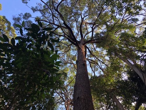
- Tree, up to 60 m tall in the wild
- Sun: not recorded
- Drought tolerance not recorded; watering not recorded
- From: AusTraits
Wildlife recorded using it: beetles, butterflies and moths, flying-foxes and blossom bats, koalas. (GloBI)
Grew on this lot before clearing (RE 12.9-10.14a, 12.9-10.14, 12.3.2). Part of the ecosystem still mapped here (RE 12.3.2, 12.9-10.14).
Blackbutt Eucalyptus pilularis
Supports threatened species near you: grey-headed flying-fox (Australia: Vulnerable, recorded within 5 km) - food (National Recovery Plan for the Grey-headed Flying-fox Pteropus poliocephalus); koala (Queensland: Endangered, Australia: Endangered, recorded within 2 km) - eats the leaves (Referral guidelines for the vulnerable koala (Queensland, New South Wales and the ACT)); glossy black-cockatoo (eastern) (Queensland: Vulnerable, Australia: Vulnerable, recorded within 10 km) - nests in hollows of old trees (Conservation Advice for Calyptorhynchus lathami lathami (south-eastern glossy black-cockatoo))
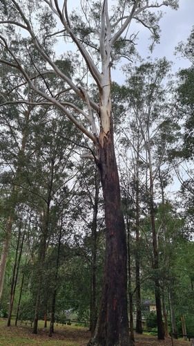
- Tree, up to 70 m tall in the wild
- Sun: not recorded
- Drought tolerance not recorded; watering not recorded
- From: AusTraits
Wildlife recorded using it: butterflies and moths, other insects, beetles, flying-foxes and blossom bats. (GloBI)
Grew on this lot before clearing (RE 12.9-10.14a, 12.9-10.14, 12.3.2). Part of the ecosystem still mapped here (RE 12.3.2, 12.9-10.14).
Turpentine Syncarpia glomulifera subsp. glomulifera
Supports threatened species near you: grey-headed flying-fox (Australia: Vulnerable, recorded within 5 km) - food (National Recovery Plan for the Grey-headed Flying-fox Pteropus poliocephalus)
 Related species
- Tree, up to 36 m tall in the wild
- Sun: not recorded
- Drought tolerance not recorded; watering not recorded
- From: AusTraits
Wildlife recorded using it: flying-foxes and blossom bats. (GloBI)
Grew on this lot before clearing (RE 12.9-10.14a, 12.9-10.14). Part of the ecosystem still mapped here (RE 12.9-10.14).
Queensland Brush Box Lophostemon confertus
Supports threatened species near you: koala (Queensland: Endangered, Australia: Endangered, recorded within 2 km) - eats the leaves (Referral guidelines for the vulnerable koala (Queensland, New South Wales and the ACT))
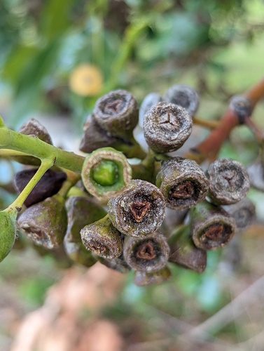
- Tree, 10 to 15 m tall, 5 to 10 m wide
- Full sun to part shade
- Drought tolerance not recorded; moderate watering
- From: Native street and garden trees in South East Queensland p. 56
Wildlife recorded using it: butterflies and moths, other insects, flying-foxes and blossom bats, koalas. (GloBI)
Grew on this lot before clearing (RE 12.9-10.14a, 12.3.2). Part of the ecosystem still mapped here (RE 12.3.2). Still growing near you (recorded within 5 km).
Shrubs and climbers
Scented Satinash Syzygium oleosum
Supports threatened species near you: grey-headed flying-fox (Australia: Vulnerable, recorded within 5 km) - food (National Recovery Plan for the Grey-headed Flying-fox Pteropus poliocephalus)
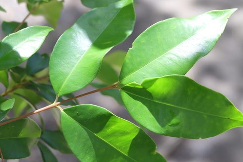
- Shrub, 4 to 15 m tall
- Full sun to part shade
- Drought tolerance not recorded; moderate watering
- From: Native plants for school gardens in South East Queensland p. 67
Wildlife recorded using it: beetles, butterflies and moths, flying-foxes and blossom bats, other insects. (GloBI)
Still growing near you (recorded within 5 km).
Hairpin Banksia Banksia spinulosa
Supports threatened species near you: grey-headed flying-fox (Australia: Vulnerable, recorded within 5 km) - food (National Recovery Plan for the Grey-headed Flying-fox Pteropus poliocephalus)
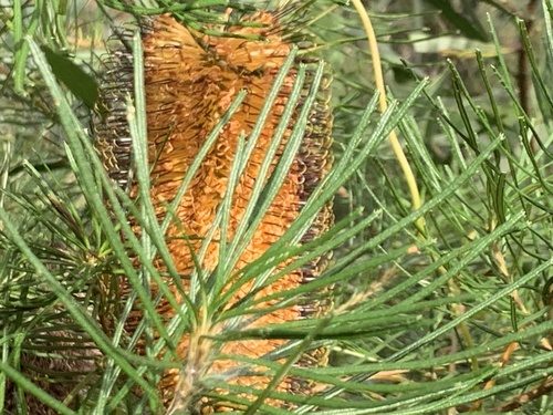
- Shrub, 3 m tall, 3 m wide
- Full sun to part shade
- Drought tolerant once established; low watering
- From: Native plants for indoors and small gardens in South East Queensland p. 82
Wildlife recorded using it: birds, native bees, beetles. (GloBI)
Still growing near you (recorded within 5 km).
Birdwing Vine Pararistolochia praevenosa
Supports threatened species near you: Richmond birdwing (Queensland: Vulnerable, recorded within 2 km) - caterpillar food plant (Queensland's protected species activity sheet: Richmond birdwing butterfly)
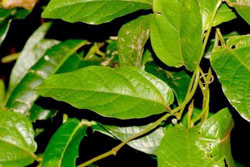
- Climber, height not recorded
- Full sun to part shade
- Drought tolerance not recorded; high watering
- From: Native plants for school gardens in South East Queensland p. 14
Wildlife recorded using it: butterflies and moths. (GloBI)
Still growing near you (recorded within 5 km).
Sweet Wattle Acacia suaveolens
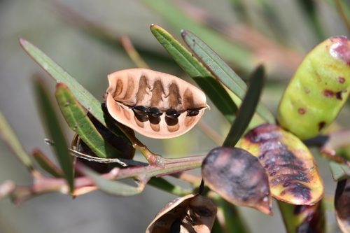
- Shrub, 2 m tall, 1 to 2 m wide
- Sun: not recorded
- Drought tolerance not recorded; watering not recorded
- From: Preferred Landscaping Species List (preferred native landscaping shrubs, park and street trees) p. 1
Wildlife recorded using it: birds, beetles, butterflies and moths, other insects. (GloBI)
Still growing near you (recorded within 5 km).
Grasses and groundcovers
Blue Flax Lily Dianella caerulea
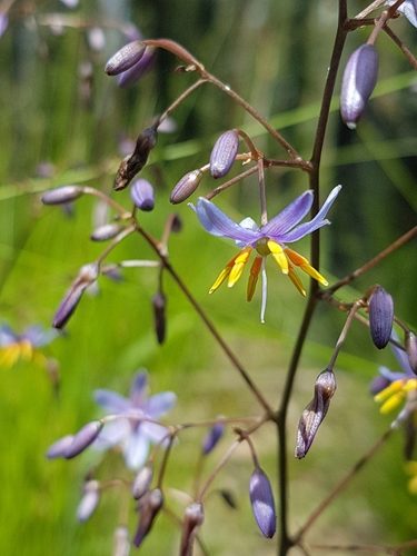
- Herb, 1 m tall
- Full sun to part shade
- Moderately drought tolerant; low watering
- From: Native plants for indoors and small gardens in South East Queensland p. 12
Wildlife recorded using it: other insects, native bees, beetles, butterflies and moths. (GloBI)
Still growing near you (recorded within 5 km).
Johnson's Grass Tree Xanthorrhoea johnsonii
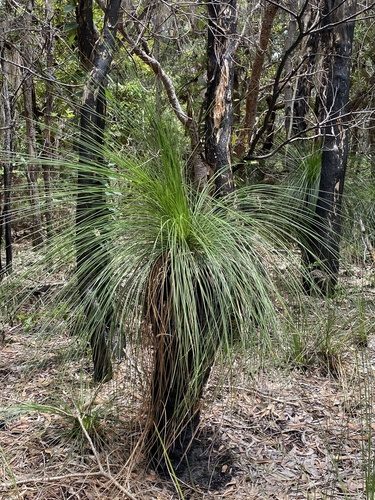
- Herb, 5 m tall, 2 m wide
- Full sun to part shade
- Drought tolerance not recorded; low watering
- From: Native plants for indoors and small gardens in South East Queensland p. 84
Wildlife recorded using it: butterflies and moths, birds, beetles, flying-foxes and blossom bats. (GloBI)
Still growing near you (recorded within 5 km).
Taller Mat Rush Lomandra longifolia
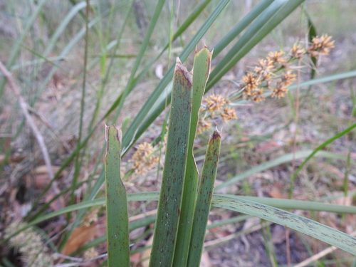
- Herb, 1 m tall, 0.6 m wide
- Full sun to shade
- Drought tolerance not recorded; low watering
- From: Native plants for school gardens in South East Queensland p. 37
Wildlife recorded using it: butterflies and moths, other insects, other mammals. (GloBI)
Still growing near you (recorded within 5 km).
Mat Rush Lomandra confertifolia
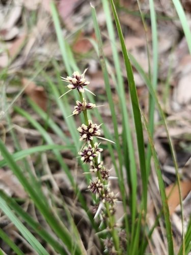
- Herb, 0.5 m tall, 1 m wide
- Full sun to part shade
- Drought tolerance not recorded; low watering
- From: Native plants for indoors and small gardens in South East Queensland p. 86
Wildlife recorded using it: butterflies and moths, other insects. (GloBI)
Still growing near you (recorded within 5 km).
How to plant
The South East Queensland Ecological Restoration Framework is the regional standard for restoration work. These links open the manual at the right page.
- Let it regrow on its own first (section 5.1.3, printed page 83)
- Why and when to plant (section 5.9, printed page 110)
- Choosing species (section 5.9.1.1, printed page 111)
- Buying good plants (section 5.9.1.2, printed page 112)
- When to plant (section 5.9.1.3, printed page 113)
- Preparing the site (section 5.9.1.4, printed page 114)
- How close to plant (section 5.9.1.6, printed page 114)
- Planting day (section 5.9.1.7, printed page 115)
- Looking after it (section 5.9.1.10, printed page 118)
Chenoweth EPLA and Bushland Restoration Services (2012), South East Queensland Ecological Restoration Framework: Manual, prepared on behalf of SEQ Catchments and the SEQ local governments. Hosted by Healthy Land & Water.
For a larger site, check with an ecologist.
Nearest community nursery
Maleny Community Nursery (Barung Landcare), Parklands Drive, via Porters Lane, North Maleny, about 9.8 km away in a straight line. Local groups grow plants from local seed, and can tell you what does well on your soil. (nursery confirmed October 2026)
06/TRIGGER MAP
Protected plants trigger map
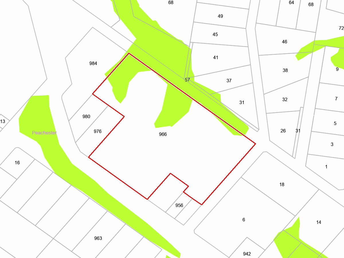
 High risk area (flora survey trigger map)
This lot is on Queensland's flora survey trigger map. A high risk area covers over 15 percent of it. That means threatened plants are known or likely to occur here. Clearing native vegetation in a trigger area needs a flora survey first, and can need a permit. If you are thinking about clearing anything, stop and check with an ecologist before you start.
Worth knowing: clearing protected plants without a permit is an offence under section 89 of the Nature Conservation Act 1992, and the penalties can be significant, so it pays to check first.
More reading
- Flora survey trigger map, what it is and how to request the official map
- Request the statutory trigger map for a lot
- Protected plants in Queensland: clearing, surveys and permits
- Exemptions and the Nature Conservation (Plants) Regulation
The threatened plants recorded near this property are listed under Threatened plants.
07/KOALAS
Koalas
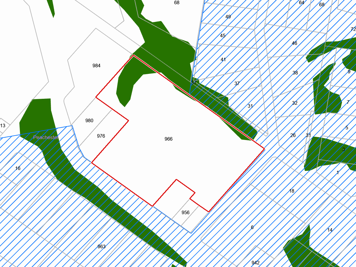
 Koala priority area
 Core koala habitat area
The South East Queensland Koala Conservation Plan maps core koala habitat over 7 percent of this lot. The trees in that area count as koala habitat, clearing them needs approval, and koalas are likely to move through. What helps: keep the eucalypts, bring dogs inside at night, koala-friendly fencing with a gap or a climbable post, and slow down on the road at dusk.
Check before you clear. Koala habitat here is mapped by the Queensland Government, and its clearing rules apply through council planning approvals. Ask an ecologist before you cut.
08/WATERWAYS
Waterways and wetlands
 Mapped wetland
 Watercourse (Water Act 2000)
 Drainage feature (Water Act 2000)
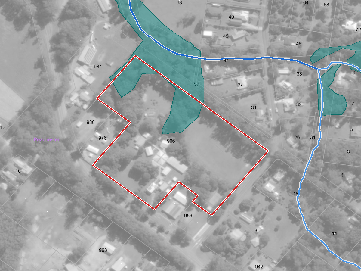
Part of this lot is mapped wetland. Wetlands are the richest habitat on most properties and the easiest to lose by draining or filling.
On this lot
- Mapped wetland (Riverine, intermittent, fresh) - on the lot
Within 250 m
- Watercourse unnamed tributary of London Creek - about 42 m away
- Watercourse (stream order 1) - about 42 m away
- Mapped wetland (Riverine) - about 42 m away
- Drainage feature unnamed tributary of London Creek - about 70 m away
- Mapped wetland - about 70 m away
- Watercourse - about 170 m away
What it means
Working in a watercourse, lake or spring is regulated. Destroying vegetation, excavating or placing fill in one needs a riverine protection permit under the Water Act 2000, unless the work meets a published exemption.
The trees along a watercourse are regulated separately, under the Vegetation Management Act 1999. The clearing codes set the distance either side of the bank that is protected, and in Great Barrier Reef catchments Category R regrowth along a watercourse cannot be cleared at all.
Wetland protection areas and wetlands of high ecological significance carry state assessment under the planning policy for wetlands: high-impact earthworks and development in or near one are decided by the state, not just the council.
What you can do. Fence stock out of the creek or wetland so the banks hold together, plant local natives along the bank for shade and for the frogs and fish, and control the weeds along the water first, where seed travels furthest - the weeds section lists what is recorded near here.
09/THREATENED ANIMALS
Threatened animals
Colour shows how threatened a species is, from critically endangered to least concern.
Coxen's fig-parrot Cyclopsitta diophthalma coxeni
 Illustration
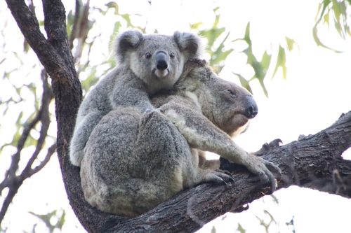
koala Phascolarctos cinereus
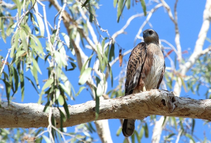
red goshawk Erythrotriorchis radiatus
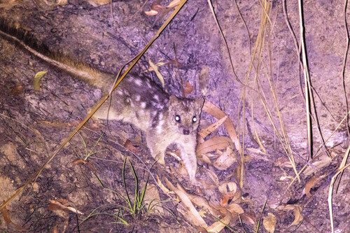
northern quoll Dasyurus hallucatus
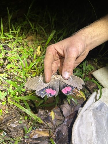
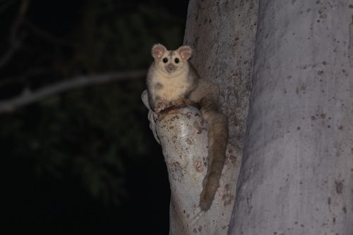
southern greater glider Petauroides volans volans
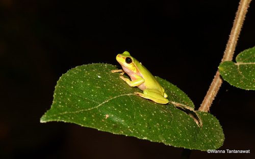
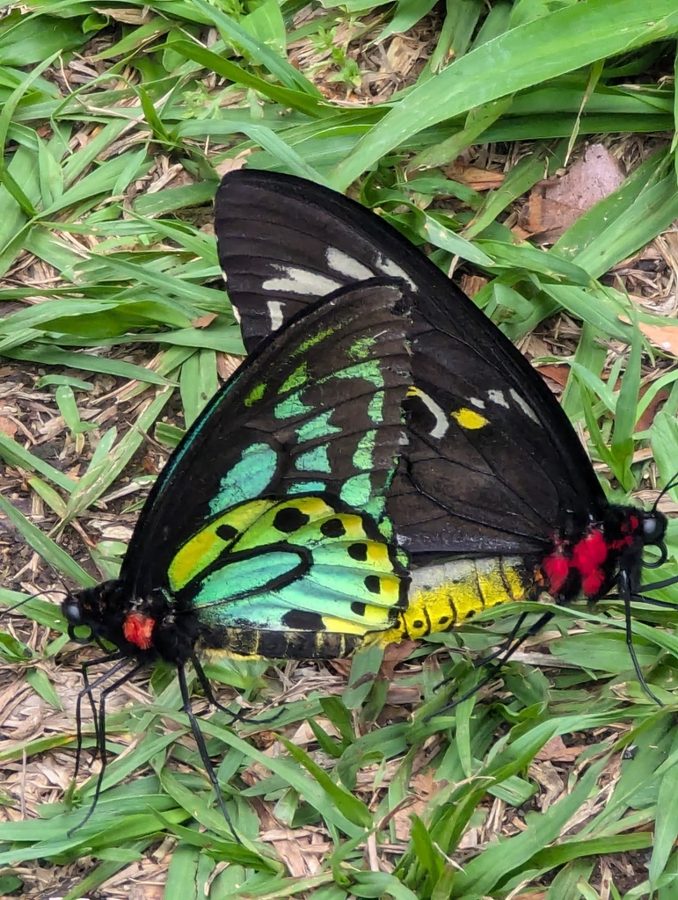
Richmond birdwing Ornithoptera richmondia
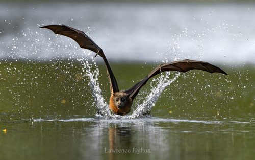
grey-headed flying-fox Pteropus poliocephalus
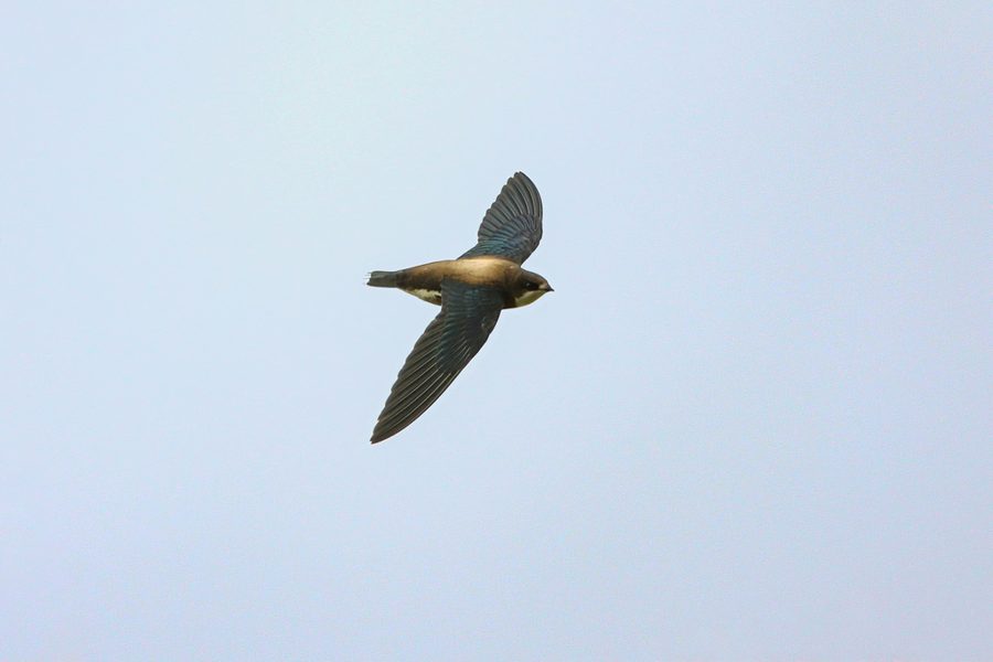
white-throated needletail Hirundapus caudacutus
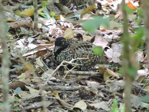
black-breasted button-quail Turnix melanogaster
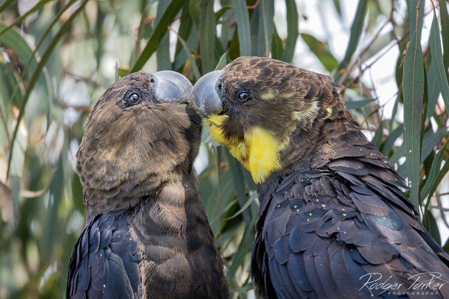
glossy black-cockatoo (eastern) Calyptorhynchus lathami lathami
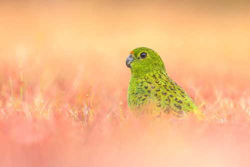
ground parrot Pezoporus wallicus wallicus
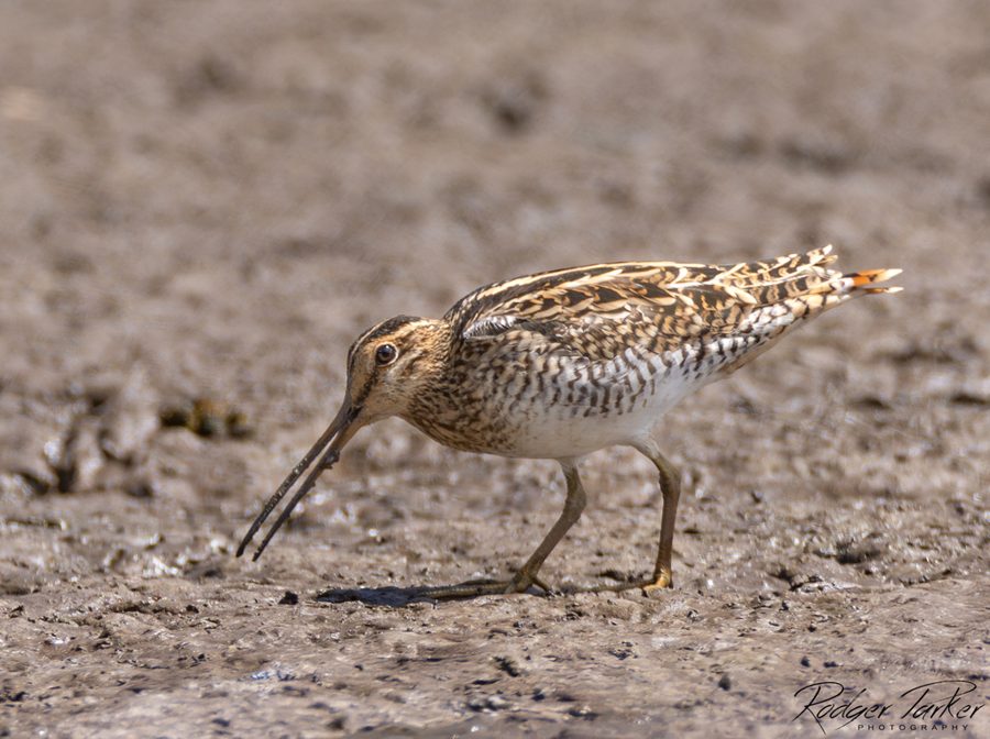
Latham's snipe Gallinago hardwickii
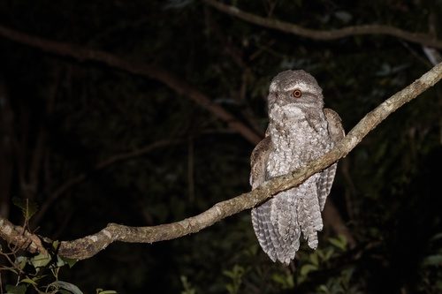
plumed frogmouth Podargus ocellatus plumiferus
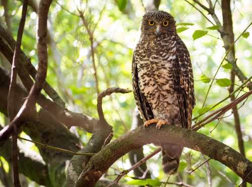
powerful owl Ninox strenua
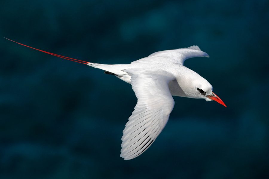
red-tailed tropicbird Phaethon rubricauda
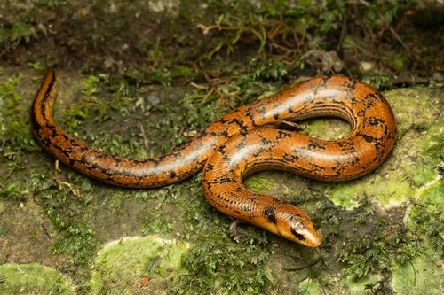
three-toed snake-tooth skink Coeranoscincus reticulatus
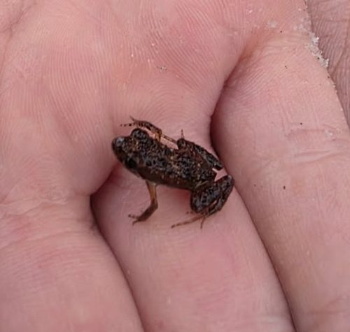
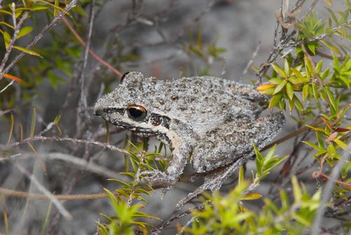
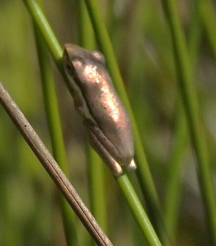
wallum sedgefrog Litoria olongburensis
10/THREATENED PLANTS
Threatened plants
Colour shows how threatened a species is, from critically endangered to least concern.
Gossia inophloia
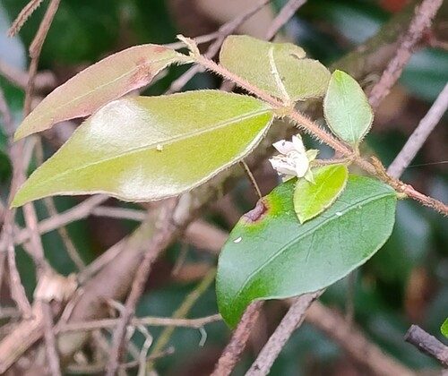
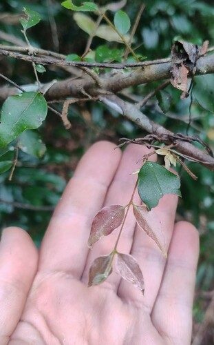
Lenwebbia sp. (Blackall Range P.R.Sharpe 5387)
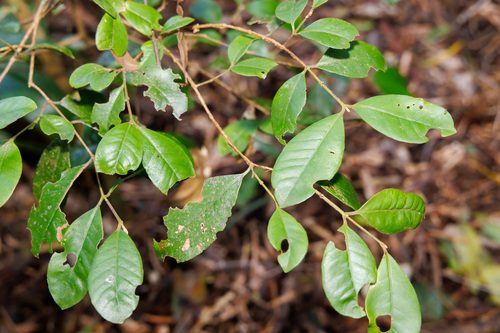
native guava Rhodomyrtus psidioides
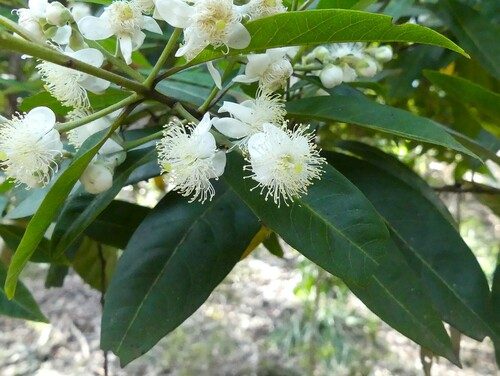
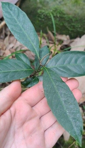
scrub turpentine Rhodamnia rubescens
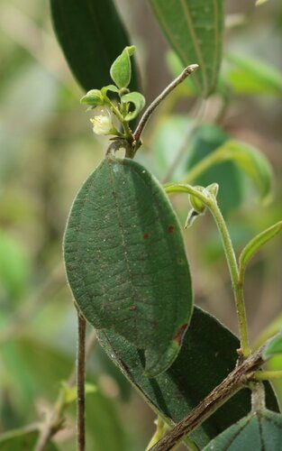
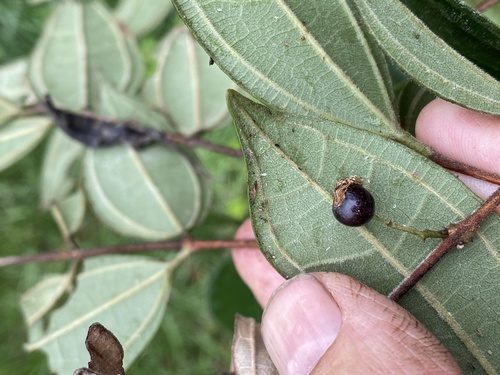
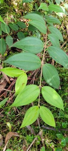
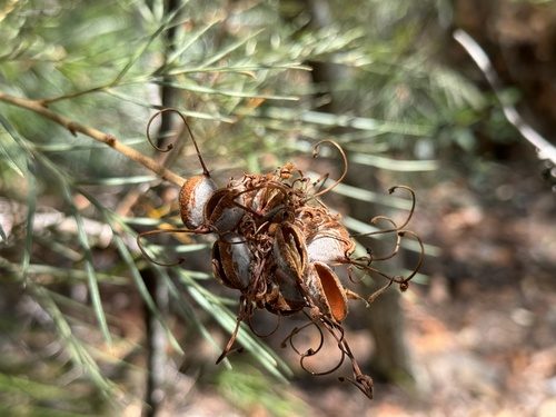
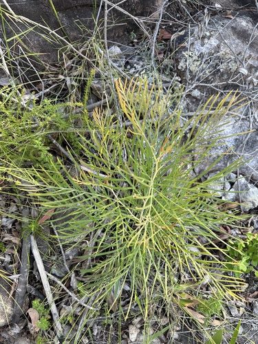
Coochin Hills grevillea Grevillea hodgei
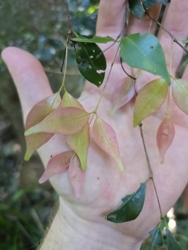
Gossia hillii
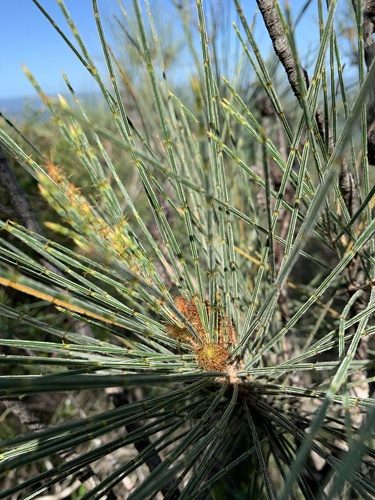
Mt. Beerwah she-oak Allocasuarina filidens
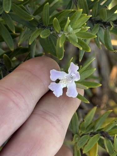
Gossia fragrantissima
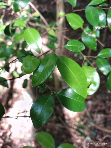
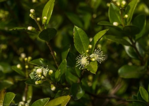
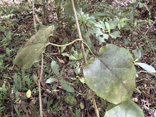
Planchonella eerwah
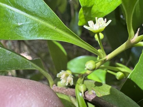
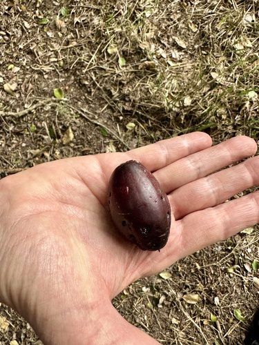
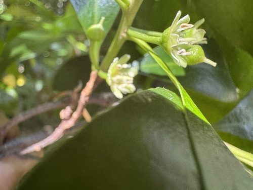
Styphelia recurvisepala
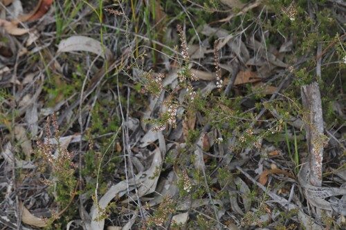
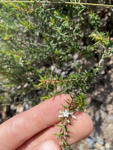
swamp stringybark Eucalyptus conglomerata
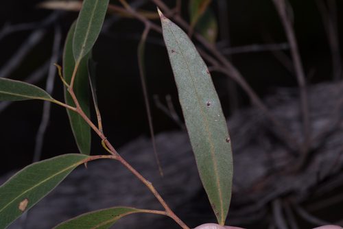
red lilly pilly Syzygium hodgkinsoniae
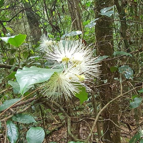
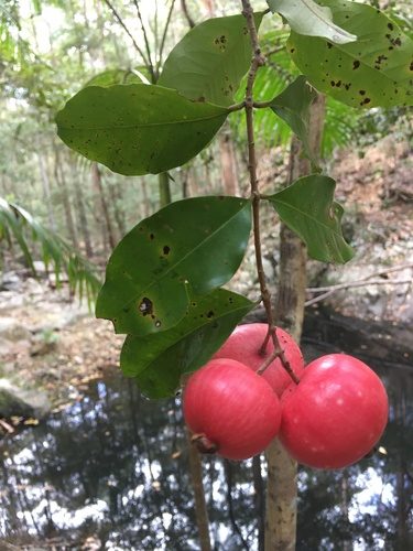
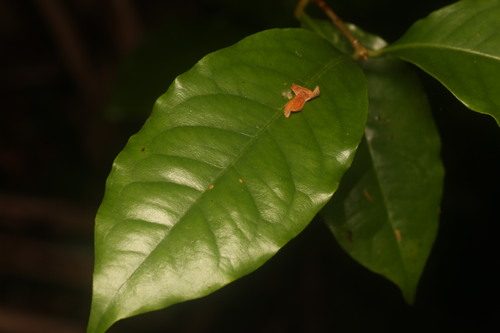
Aggreflorum luehmannii
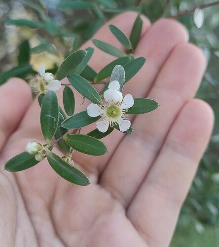
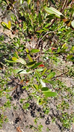
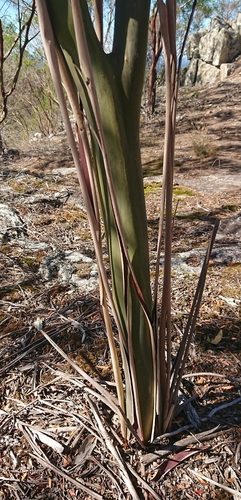
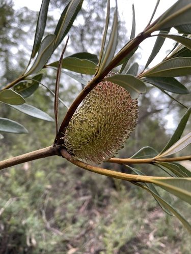
Gonocarpus effusus
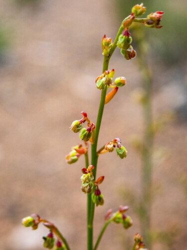
Mt. Beerwah mallee Eucalyptus kabiana
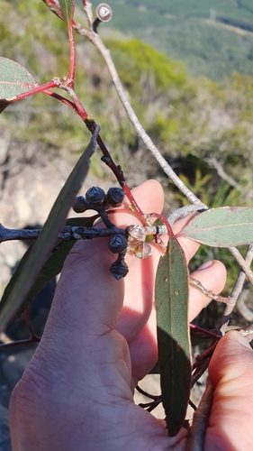
Romnalda strobilacea
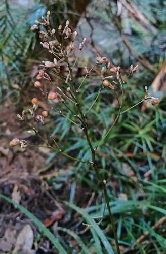
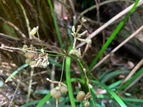
rusty oak Helicia ferruginea
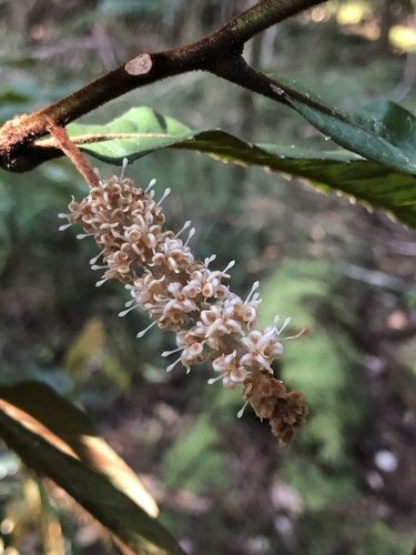
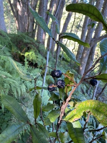
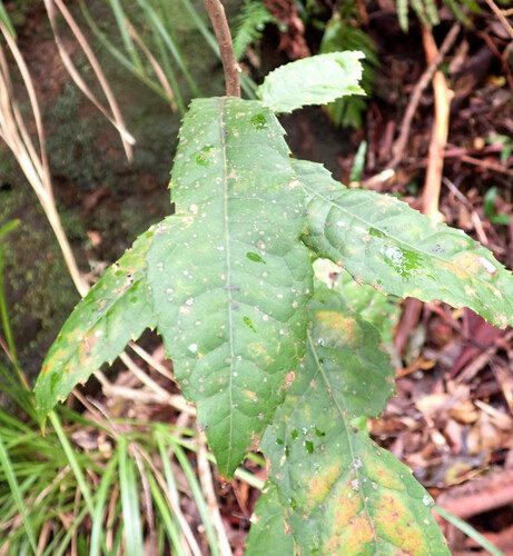
small-fruited Queensland nut Macadamia ternifolia
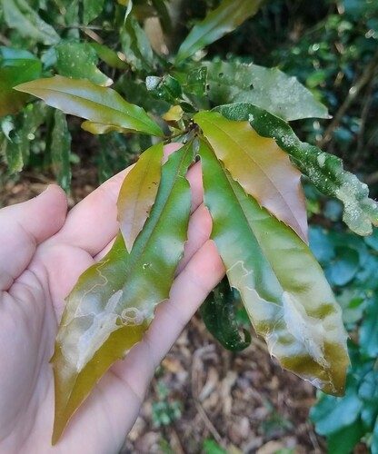
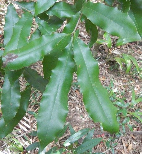
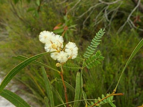
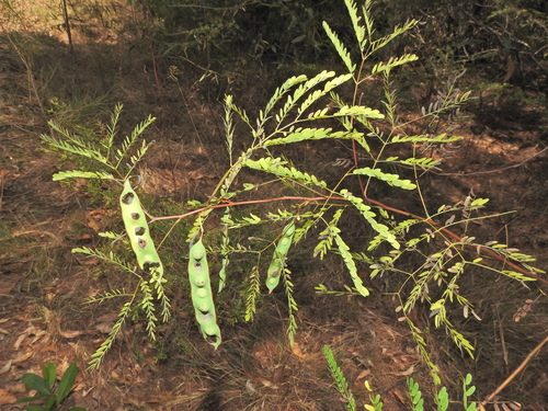
Acacia attenuata
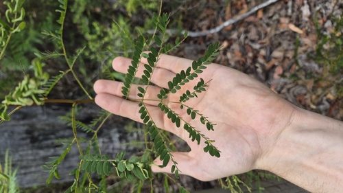
fine-leaved tuckeroo Lepiderema pulchella
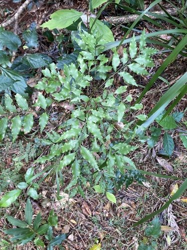
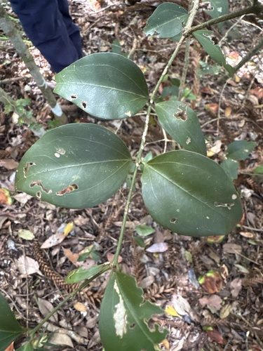
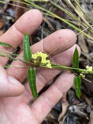
Leichhardtia coronata
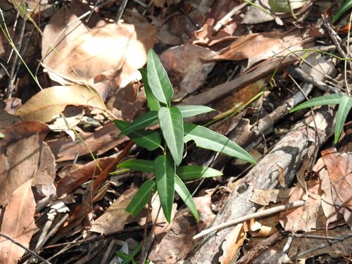
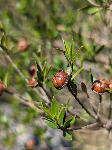
Macadamia tetraphylla
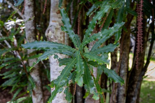
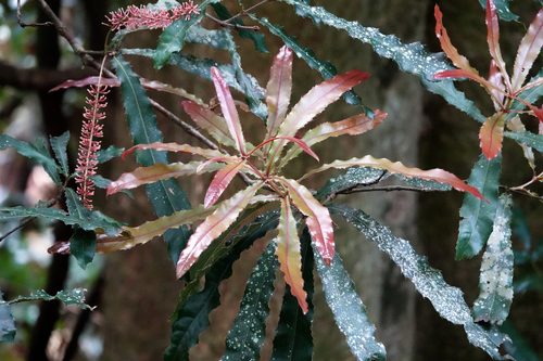
Ricinocarpos speciosus
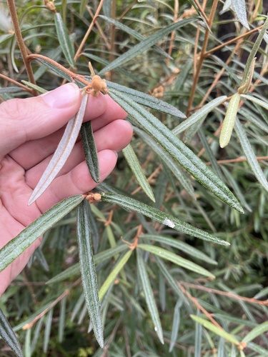
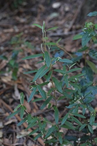
southern corynocarpus Corynocarpus rupestris subsp. arborescens
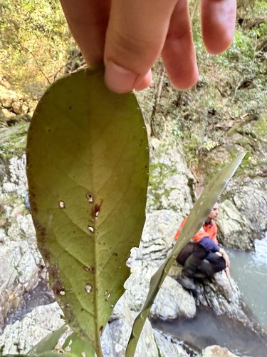
three-leaved bosistoa Bosistoa transversa
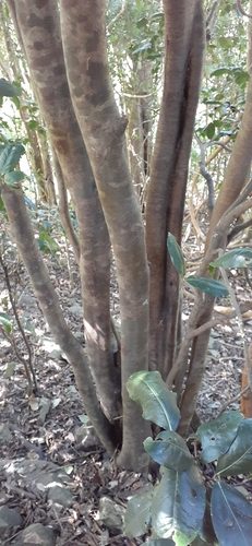
11/LOST
Lost biodiversity in your area
These species were recorded in this district and are now listed as extinct or extinct in the wild. They are part of the story of this place, and a reminder of what protecting habitat is for.
- southern gastric brooding frog Rheobatrachus silusQueensland: Extinct in the wildAustralia: Extinct
12/WEEDS
Known weeds nearby
Records within 2 km of introduced plants that are on a weed list. A record nearby does not mean the weed is on the property; it means it is worth learning to recognise.
Badges show which list a weed is on and what that means for you.
The 32 worst weeds agreed nationally; management is a priority everywhere. Weeds Australia
Must not be given away, sold or released into the environment. Everyone has a duty to take reasonable steps to stop it spreading. Business Queensland: restricted plants
Must not be given away, sold or released into the environment. Must not be kept. Everyone has a duty to take reasonable steps to stop it spreading. Business Queensland: restricted plants
A biological control agent has been released for this weed in Queensland. The card names it and says whether you can get one.
Biosecurity Queensland maps the weed as established around this district, with no record within 2 km. Source: Biosecurity Queensland weed distribution mapping.
Recorded within 2 km
camphor laurel Cinnamomum camphora
Must not be given away, sold or released into the environment. Everyone has a duty to take reasonable steps to stop it spreading.
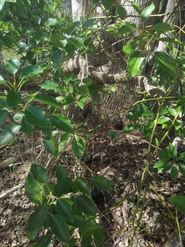
groundsel bush Baccharis halimifolia
Must not be given away, sold or released into the environment. Everyone has a duty to take reasonable steps to stop it spreading.
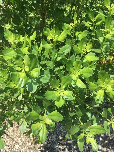
broad-leaf privet Ligustrum lucidum
Must not be given away, sold or released into the environment. Everyone has a duty to take reasonable steps to stop it spreading.
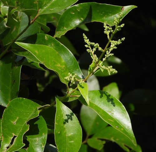
small-leaf privet Ligustrum sinense
Must not be given away, sold or released into the environment. Everyone has a duty to take reasonable steps to stop it spreading.
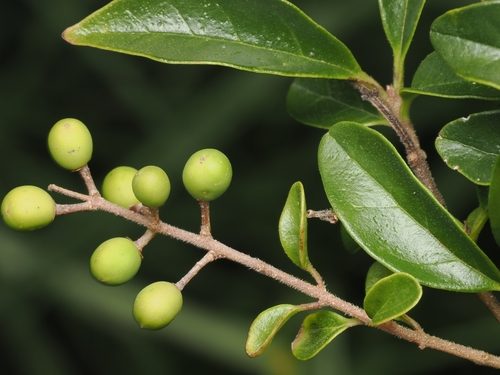
Parramatta grass Sporobolus africanus
Must not be given away, sold or released into the environment. Everyone has a duty to take reasonable steps to stop it spreading.
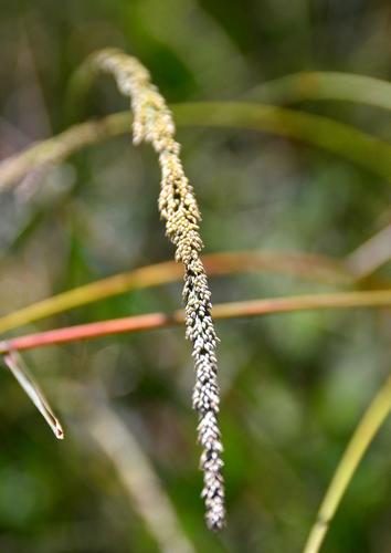
Known in this district
Biosecurity Queensland maps where each declared weed is established at a district scale. These are mapped as present around Peachester, even though no record within 2 km was found. Worth learning to recognise.
alligator weed Alternanthera philoxeroides
Must not be given away, sold or released into the environment. Everyone has a duty to take reasonable steps to stop it spreading.
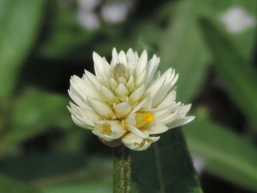
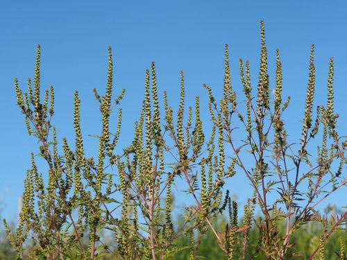
annual ragweed Ambrosia artemisiifolia
Must not be given away, sold or released into the environment. Everyone has a duty to take reasonable steps to stop it spreading.
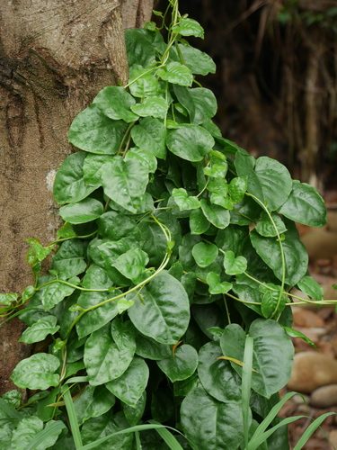
Madeira vine Anredera cordifolia
Must not be given away, sold or released into the environment. Everyone has a duty to take reasonable steps to stop it spreading.
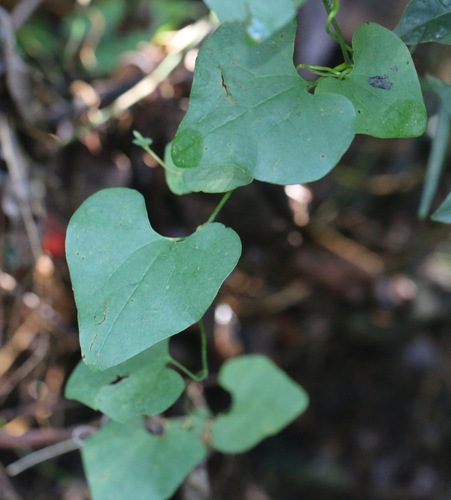
Dutchman's pipe Aristolochia elegans
Must not be given away, sold or released into the environment. Everyone has a duty to take reasonable steps to stop it spreading.
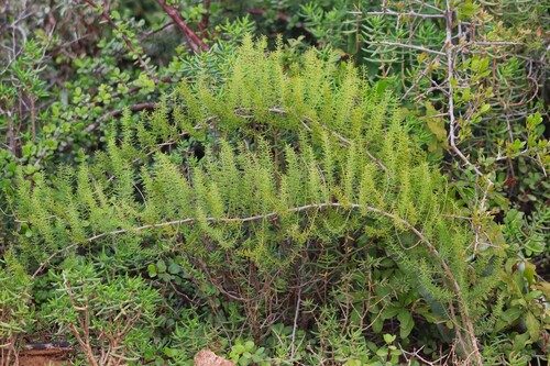
asparagus fern Asparagus aethiopicus
Must not be given away, sold or released into the environment. Everyone has a duty to take reasonable steps to stop it spreading.
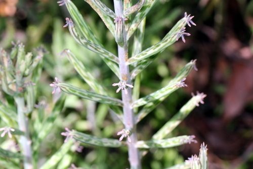
mother of millions Bryophyllum delagoense
Must not be given away, sold or released into the environment. Everyone has a duty to take reasonable steps to stop it spreading.
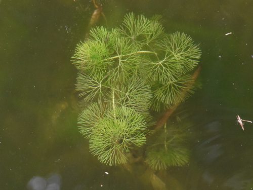
cabomba Cabomba caroliniana
Must not be given away, sold or released into the environment. Everyone has a duty to take reasonable steps to stop it spreading.
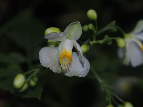
balloon vine Cardiospermum grandiflorum
Must not be given away, sold or released into the environment. Everyone has a duty to take reasonable steps to stop it spreading.
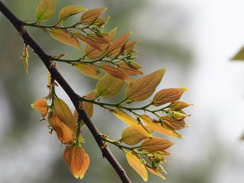
Chinese celtis Celtis sinensis
Must not be given away, sold or released into the environment. Everyone has a duty to take reasonable steps to stop it spreading.
cat's claw creeper Dolichandra unguis-cati
Must not be given away, sold or released into the environment. Everyone has a duty to take reasonable steps to stop it spreading.
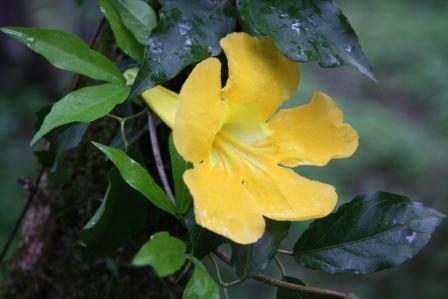
water hyacinth Eichhornia crassipes
Must not be given away, sold or released into the environment. Everyone has a duty to take reasonable steps to stop it spreading.
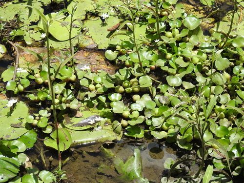
kahili ginger Hedychium gardnerianum
Must not be given away, sold or released into the environment. Everyone has a duty to take reasonable steps to stop it spreading.
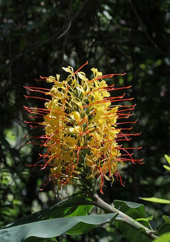
kidneyleaf mudplantain Heteranthera reniformis
Must not be given away, sold or released into the environment. Must not be kept. Everyone has a duty to take reasonable steps to stop it spreading.
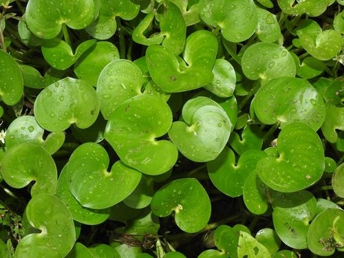
hygrophila Hygrophila costata
Must not be given away, sold or released into the environment. Everyone has a duty to take reasonable steps to stop it spreading.
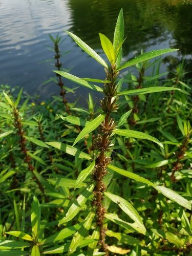
lantana Lantana camara
Must not be given away, sold or released into the environment. Everyone has a duty to take reasonable steps to stop it spreading.
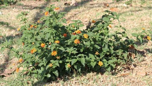
water lettuce Pistia stratiotes
Must not be given away, sold or released into the environment. Everyone has a duty to take reasonable steps to stop it spreading.
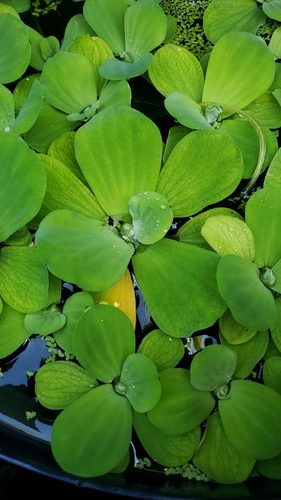
blackberry Rubus anglocandicans
Must not be given away, sold or released into the environment. Everyone has a duty to take reasonable steps to stop it spreading.
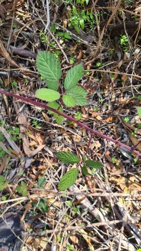
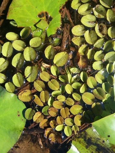
salvinia Salvinia molesta
Must not be given away, sold or released into the environment. Everyone has a duty to take reasonable steps to stop it spreading.
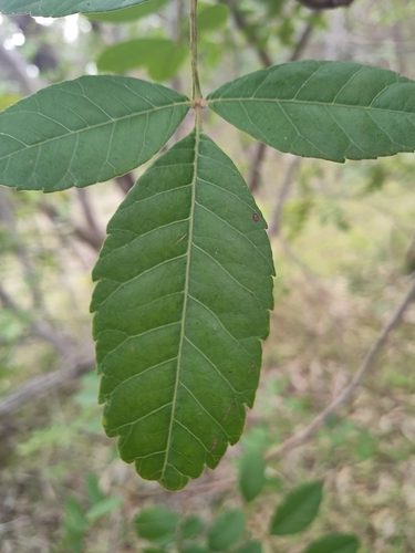
broad-leaved pepper tree Schinus terebinthifolius
Must not be given away, sold or released into the environment. Everyone has a duty to take reasonable steps to stop it spreading.
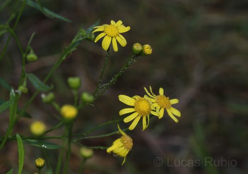
fireweed Senecio madagascariensis
Must not be given away, sold or released into the environment. Everyone has a duty to take reasonable steps to stop it spreading.
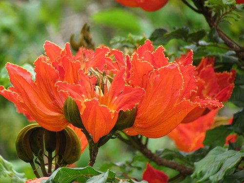
African tulip tree Spathodea campanulata
Must not be given away, sold or released into the environment. Everyone has a duty to take reasonable steps to stop it spreading.
Singapore daisy Sphagneticola trilobata
Must not be given away, sold or released into the environment. Everyone has a duty to take reasonable steps to stop it spreading.
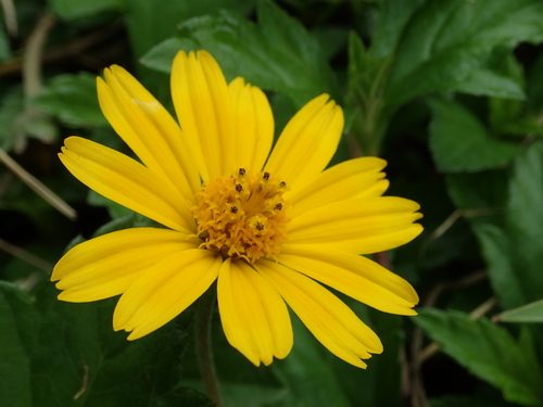
Rat's tail grasses Sporobolus spp.
Must not be given away, sold or released into the environment. Everyone has a duty to take reasonable steps to stop it spreading.
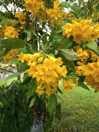
yellow bells Tecoma stans
Must not be given away, sold or released into the environment. Everyone has a duty to take reasonable steps to stop it spreading.
Sources: WildNet, Atlas of Living Australia, iNaturalist and Biosecurity Queensland weed distribution mapping, checked 30 October 2026. Records from the last 30 years for WildNet, Atlas of Living Australia and iNaturalist.
13/FIRE ANTS
Fire ants
This lot is outside the fire ant biosecurity zones as at 2026-10-30. Zones grow as new nests are found. If you see suspicious ants, report them.
Report suspected fire ants within 24 hours at fireants.org.au or on 13 25 23.
14/TIPS
Tips for this place
- A creek or wetland runs through this place. Fence stock out of it and plant local natives along the bank; the water, the frogs and the fish downstream all get better.
- Listed weeds are recorded close by: camphor laurel, groundsel bush, broad-leaf privet. Learning to recognise them and pulling them out while they are small is one of the most useful things a household can do.
- Not many threatened species are recorded near here yet, which often means nobody has looked. Photograph what you find with the iNaturalist app and post it, and this report changes.
- Before you clear anything, check. Native vegetation here is protected for a reason, and a flora survey or a permit can be required.
- Want to go further? Land for Wildlife supports landholders who keep habitat on their land. Learn more
15/HOW TO READ THIS
How to read this
Maps are clues, not sightings. Habitat mapping and nearby records help you explore what could be around you. They do not prove a species is on the property. Records may be old or approximate, and some sensitive species locations are deliberately blurred by the state.
Species records come from the Queensland Government's WildNet database, searched at 2, 5 and 10 km from the lot boundary. Conservation status is the Queensland Nature Conservation Act listing and the Australian EPBC Act listing.
A sighting you post on iNaturalist becomes part of the Atlas of Living Australia, which is where records like the ones in this report come from. That is the loop: this report reads from citizen science, and you can add to it.
Your local members
Council: Sunshine Coast Regional.
State electorate: Glass House, Andrew Powell (LNP). Tell your local member what you found
Federal electorate: Fisher, Andrew Wallace (LNP). Tell your local member what you found
Your nearest Landcare group is Barung Landcare Association Inc in Maleny, 9.8 km away.
Sources
- https://biocache-ws.ala.org.au/ws/occurrences/search
- https://services.arcgisonline.com/ArcGIS/rest/services/World_Imagery/MapServer/export
- https://spatial-gis.information.qld.gov.au/arcgis/rest/services
- https://spatial-gis.information.qld.gov.au/arcgis/rest/services/Basemaps/QldBase_Colour/MapServer
- https://spatial-gis.information.qld.gov.au/arcgis/rest/services/Basemaps/QldMap_Topo/MapServer
- https://spatial-gis.information.qld.gov.au/arcgis/rest/services/Biota/BiodiversityPlanningAssessments/MapServer
- https://spatial-gis.information.qld.gov.au/arcgis/rest/services/Biota/FloraFaunaDiversity/MapServer/400
- https://spatial-gis.information.qld.gov.au/arcgis/rest/services/Biota/RegionalEcosystemMapping/MapServer/1
- https://spatial-gis.information.qld.gov.au/arcgis/rest/services/Biota/StatewideBiodiversityCorridors/MapServer
- https://spatial-gis.information.qld.gov.au/arcgis/rest/services/Biota/VegetationManagement/MapServer
- https://spatial-gis.information.qld.gov.au/arcgis/rest/services/Biota/Wetlands/MapServer
- https://spatial-gis.information.qld.gov.au/arcgis/rest/services/Environment/KoalaPlan/MapServer
- https://spatial-gis.information.qld.gov.au/arcgis/rest/services/Environment/MattersOfStateEnvironmentalSignificance/MapServer
- https://spatial-gis.information.qld.gov.au/arcgis/rest/services/Environment/ParksTerrestrialProtectedAreas/MapServer
- https://spatial-gis.information.qld.gov.au/arcgis/rest/services/Environment/WaterAndWetlandBiodiversity/MapServer
- https://spatial-gis.information.qld.gov.au/arcgis/rest/services/Environment/WetlandProtection/MapServer
- https://spatial-gis.information.qld.gov.au/arcgis/rest/services/Farming/Biosecurity/MapServer
- https://spatial-gis.information.qld.gov.au/arcgis/rest/services/InlandWaters/WatercourseIdentificationMap/MapServer
- https://spatial-gis.information.qld.gov.au/arcgis/rest/services/PlanningCadastre/LandParcelPropertyFramework/MapServer
- https://spatial-img.information.qld.gov.au/arcgis/rest/services/Basemaps/LatestStateProgram_AllUsers/ImageServer
16/RESOURCES
Ecological resources
Why understanding biodiversity is hard
The information about one property is split across three levels of government, and each level keeps its own maps, registers, apps and laws. The Commonwealth lists nationally protected species, the State maps vegetation, wetlands, koalas, weeds and species records across a dozen separate systems, and your council runs its own planning scheme and its own environmental plans on top of both. Nothing joins them up for a single address, which is what this report tries to do. Everything below is where to go next, and who runs it.
Federal
Commonwealth environment law
- EPBC Act overviewDepartment of Climate Change, Energy, the Environment and WaterWhat the national environment law protects and when it applies to you.
- Protected Matters Search ToolDepartment of Climate Change, Energy, the Environment and WaterDraw an area and get every nationally listed species and place it may hold.
- Environment Protection and Biodiversity Conservation Act 1999Federal Register of LegislationThe Act itself, as currently in force.
- EPBC Act publications and guidanceDepartment of Climate Change, Energy, the Environment and WaterReferral guidelines, survey guidelines and policy statements by species group.
- Survey guidelines for referred actionsDepartment of Climate Change, Energy, the Environment and WaterHow much survey effort the Commonwealth expects before it accepts an absence.
- The federal environment departmentDepartment of Climate Change, Energy, the Environment and WaterThe department that administers national environment law today.
- National EPAAustralian GovernmentThe new national environment regulator that federal assessment work is moving to.
National species and records
- Species Profile and Threats Database (SPRAT)Department of Climate Change, Energy, the Environment and WaterA profile per nationally listed species: what it looks like, where it lives, what threatens it.
- Threatened species and ecological communitiesDepartment of Climate Change, Energy, the Environment and WaterThe national lists, recovery plans and key threatening processes.
- Species of National Environmental Significance dataDepartment of Climate Change, Energy, the Environment and WaterThe modelled distribution layers behind the Protected Matters Search Tool.
- Atlas of Living AustraliaAtlas of Living Australia, hosted by CSIROAustralia's pooled biodiversity records, including museum, herbarium and citizen science data.
- Atlas of Living Australia occurrence searchAtlas of Living Australia, hosted by CSIROSearch records by species, by area or by a radius around a point.
- Australian Faunal DirectoryAustralian Biological Resources StudyThe national checklist of Australian animal names and their taxonomy.
National weed lists
- Weeds of National SignificanceWeeds Australia, Centre for Invasive Species SolutionsThe 32 weeds agreed nationally as the worst, each with a management guide.
- National weed listsWeeds Australia, Centre for Invasive Species SolutionsEvery national list Weeds Australia keeps: eradication targets, established weeds and import restrictions. The old Alert List is no longer published.
- Weed profilesWeeds Australia, Centre for Invasive Species SolutionsIdentification photographs and control notes, species by species.
- Established pests and weedsDepartment of Agriculture, Fisheries and ForestryThe Commonwealth's role in weeds and pest animals already here.
- Weeds in AustraliaDepartment of Climate Change, Energy, the Environment and WaterWhy weeds are listed as a key threatening process under national environment law.
Regional natural resource management bodies
- NRM Regions QueenslandNRM Regions QueenslandThe peak body for Queensland's regional natural resource management groups.
- NRM Regions AustraliaNRM Regions AustraliaFind the regional body for any address in the country.
- Healthy Land and WaterHealthy Land and WaterSouth East Queensland: catchment health reporting, restoration and nursery advice.
- Burnett Mary Regional GroupBurnett Mary Regional GroupBundaberg to Gympie and inland: revegetation, turtles, water quality.
- Fitzroy Basin AssociationFitzroy Basin AssociationCentral Queensland's Fitzroy catchment: grazing land, reef water quality, weeds.
- Terrain NRMTerrain NRMWet Tropics: rainforest restoration, cassowaries and reef catchments.
- NQ Dry TropicsNQ Dry TropicsBurdekin dry tropics: grazing land condition, wetlands and coastal habitat.
- Reef CatchmentsReef CatchmentsMackay, Whitsunday and Isaac: coastal wetlands, waterways and remnant vegetation.
- Cape York NRMCape York Natural Resource ManagementCape York Peninsula, working with traditional owners on country.
- Torres Strait Regional AuthorityTorres Strait Regional AuthorityLand and sea management across the Torres Strait islands.
- Southern Gulf NRMSouthern Gulf NRMMount Isa and the southern Gulf: rangelands, weeds and river systems.
- Desert Channels QueenslandDesert Channels QueenslandChannel country: prickly acacia, artesian springs and rangeland condition.
- South West NRMSouth West NRMMulga lands: grazing, threatened species and water in the far south west.
- Queensland Murray-Darling CommitteeQueensland Murray-Darling CommitteeQueensland's Murray-Darling headwaters: soils, waterways and native vegetation.
- Condamine AllianceCondamine AllianceThe Condamine catchment on the Darling Downs.
State
Maps and mapping apps
- Queensland GlobeDepartment of Natural Resources and Mines, Manufacturing, and Regional and Rural DevelopmentThe State's own map viewer: property boundaries, vegetation, wetlands, imagery, hundreds of layers.
- Queensland Spatial Catalogue (QSpatial)Department of Natural Resources and Mines, Manufacturing, and Regional and Rural DevelopmentDownload the actual datasets behind the maps, layer by layer.
- Queensland spatial services and web mapsDepartment of Natural Resources and Mines, Manufacturing, and Regional and Rural DevelopmentThe map services this report itself queries, browsable as apps and layers.
- BioMapsDepartment of the Environment, Tourism, Science and InnovationPublished species records and biodiversity layers, with a report for any area you draw.
- Environmental reports onlineDepartment of the Environment, Tourism, Science and InnovationFree automated reports on the environmental values of a property.
- Vegetation mapsDepartment of Natural Resources and Mines, Manufacturing, and Regional and Rural DevelopmentThe regulated vegetation management map and the categories it uses.
- Request a free vegetation management report or mapDepartment of Natural Resources and Mines, Manufacturing, and Regional and Rural DevelopmentAsk the State for a property report showing your lot's vegetation categories.
- Regional ecosystem descriptions database (REDD)Queensland Herbarium, Department of the Environment, Tourism, Science and InnovationLook up any regional ecosystem code and read what grows there and how it is faring.
- Vegetation management regional ecosystem lookupDepartment of Natural Resources and Mines, Manufacturing, and Regional and Rural DevelopmentThe same codes as they are used by the clearing laws.
- WetlandInfoDepartment of the Environment, Tourism, Science and InnovationEverything the State knows about wetlands, from maps to management advice.
- WetlandSummary facts and mapsDepartment of the Environment, Tourism, Science and InnovationA wetland report for any catchment, local government area or region.
- WildNetDepartment of the Environment, Tourism, Science and InnovationThe State's species record database. It is the source of the species lists in this report.
- WildNet platform and species listsDepartment of the Environment, Tourism, Science and InnovationHow to request a species list for your own area, and what the records mean.
- Species informationDepartment of the Environment, Tourism, Science and InnovationProfiles, conservation status and where to send your own sightings.
- Protected plants flora survey trigger mapDepartment of the Environment, Tourism, Science and InnovationCheck whether a flora survey is required before clearing on your lot.
- Koala habitat mapping for South East QueenslandDepartment of the Environment, Tourism, Science and InnovationKoala habitat areas and priority areas under the South East Queensland koala strategy.
- Koala mapping and regulationDepartment of the Environment, Tourism, Science and InnovationWhat the koala maps mean for clearing and development in the south east.
- South East Queensland Koala Conservation Strategy dataQueensland Government Open Data PortalDownload the koala habitat areas, priority areas and restoration areas.
- Matters of state environmental significance mapping methodDepartment of the Environment, Tourism, Science and InnovationThe 22 layers that make up the State's biodiversity mapping, and how each is built.
- Matters of state environmental significance dataQueensland Government Open Data PortalDownload the mapping itself.
- State planning mappingDepartment of State Development, Infrastructure and PlanningThe State Planning Policy interactive mapping and the development assessment mapping system.
- Invasive plants and weedsBiosecurity Queensland, Department of Primary IndustriesEvery declared weed in Queensland, what category it is, and where it is established.
- Restricted invasive plantsBiosecurity Queensland, Department of Primary IndustriesThe restricted categories and what each one obliges you to do.
- Fire antsNational Fire Ant Eradication Program, Biosecurity QueenslandCheck whether your address is in a fire ant biosecurity zone, and report a nest.
- Environmental offsetsDepartment of the Environment, Tourism, Science and InnovationWhen a loss of habitat has to be offset, and where offset sites are registered.
- Offsets calculatorDepartment of the Environment, Tourism, Science and InnovationThe State's own tool for sizing a financially settled offset.
- Queensland HerbariumQueensland Herbarium, Department of the Environment, Tourism, Science and InnovationThe State's plant collection. It will identify a specimen you send in.
- National parks and protected areasQueensland Parks and Wildlife ServiceThe protected area estate, and the park nearest you.
- Land for Wildlife South East QueenslandLand for Wildlife South East QueenslandFree property visits and habitat advice for landholders keeping bushland.
- Queensland Heritage RegisterDepartment of the Environment, Tourism, Science and InnovationSearch whether a place is on the State heritage register.
Departments and who to ask
- Department of the Environment, Tourism, Science and InnovationQueensland GovernmentDETSI: species records, wetlands, koalas, protected plants, offsets, national parks.
- Environment, land and waterQueensland GovernmentThe plain-English front door to every state environmental service.
- Land and vegetation managementDepartment of Natural Resources and Mines, Manufacturing, and Regional and Rural DevelopmentThe department that administers the vegetation clearing laws and the maps behind them.
- Department of Natural Resources and Mines, Manufacturing, and Regional and Rural DevelopmentQueensland GovernmentVegetation management, property mapping, water and land titles.
- Department of Primary IndustriesQueensland GovernmentBiosecurity Queensland sits here: declared weeds and pests, fire ants, biosecurity zones.
- BiosecurityBiosecurity Queensland, Department of Primary IndustriesWhat the State expects of a landholder for pests, weeds and disease.
- Department of State Development, Infrastructure and PlanningQueensland GovernmentHosts the State Assessment and Referral Agency (SARA), the state's referral agency for development.
- Planning QueenslandDepartment of State Development, Infrastructure and PlanningThe planning framework, regional plans and state planning mapping.
- Notify the State of clearing under a codeDepartment of Natural Resources and Mines, Manufacturing, and Regional and Rural DevelopmentWhere an accepted development clearing code notification is actually lodged.
Clearing rules, plain English first
- Understanding Queensland's native vegetation clearing lawsDepartment of Natural Resources and Mines, Manufacturing, and Regional and Rural DevelopmentStart here. What you may and may not clear, in ordinary words.
- Exempt clearing workDepartment of Natural Resources and Mines, Manufacturing, and Regional and Rural DevelopmentThe clearing that needs no approval at all, listed exactly.
- Accepted development vegetation clearing codesDepartment of Natural Resources and Mines, Manufacturing, and Regional and Rural DevelopmentClearing you may do by notifying the State and following a code.
- Clearing codes and approvalsDepartment of Natural Resources and Mines, Manufacturing, and Regional and Rural DevelopmentEvery pathway from exempt through to a development approval.
- Area management plansDepartment of Natural Resources and Mines, Manufacturing, and Regional and Rural DevelopmentA plan covering a whole area that a landholder can clear under.
- Property maps of assessable vegetation (PMAV)Department of Natural Resources and Mines, Manufacturing, and Regional and Rural DevelopmentHow to lock in or correct the vegetation categories mapped over your lot.
- Vegetation categoriesDepartment of Natural Resources and Mines, Manufacturing, and Regional and Rural DevelopmentWhat each mapped category means for what you can do.
- Landholder clearing guidesDepartment of Natural Resources and Mines, Manufacturing, and Regional and Rural DevelopmentShort guides written for landholders rather than consultants.
- Protected plantsDepartment of the Environment, Tourism, Science and InnovationWhich plants are protected in Queensland and what that protection means.
- Clearing of protected plants, permits and survey guidelinesDepartment of the Environment, Tourism, Science and InnovationThe permit, the exemptions, and the flora survey guideline a survey must follow.
- KoalasDepartment of the Environment, Tourism, Science and InnovationLiving with koalas, and the rules that protect their habitat in the south east.
- Water permits and licencesDepartment of Natural Resources and Mines, Manufacturing, and Regional and Rural DevelopmentWorks in a watercourse, taking water, and the riverine protection permits.
- Aboriginal and Torres Strait Islander cultural heritageQueensland GovernmentThe cultural heritage duty of care every landholder carries before disturbing ground.
- Heritage placesDepartment of the Environment, Tourism, Science and InnovationWhat protection a heritage listing gives a place, and how listing works.
- Biosecurity laws and regulationsBiosecurity Queensland, Department of Primary IndustriesThe general biosecurity obligation: you must take reasonable steps about pests you know of.
- Fishing and aquacultureFisheries Queensland, Department of Primary IndustriesMarine plants and declared fish habitat areas sit under the fisheries laws.
The Acts themselves
- Vegetation Management Act 1999Queensland LegislationThe Act behind the regulated vegetation map and every clearing category.
- Nature Conservation Act 1992Queensland LegislationProtects native plants and animals and creates the protected area estate.
- Nature Conservation (Plants) Regulation 2020Queensland LegislationHow protected plants are classed and what a clearing permit requires.
- Nature Conservation (Animals) Regulation 2020Queensland LegislationHow native animals are classed, and what you may and may not do with them.
- Environmental Protection Act 1994Queensland LegislationThe general duty not to cause environmental harm, and the activities that need a licence.
- Planning Act 2016Queensland LegislationThe Act every council planning scheme is made under.
- Planning Regulation 2017Queensland LegislationCarries the South East Queensland koala habitat provisions and the state referral triggers.
- Biosecurity Act 2014Queensland LegislationDeclared weeds and pests, biosecurity zones, and the general biosecurity obligation.
- Water Act 2000Queensland LegislationTaking water, and destroying vegetation or excavating in a watercourse.
- Fisheries Act 1994Queensland LegislationProtects marine plants, including mangroves, and declared fish habitat areas.
- Environmental Offsets Act 2014Queensland LegislationWhen a significant residual impact must be offset, and how.
- Queensland Heritage Act 1992Queensland LegislationThe State heritage register and what listing obliges an owner to do.
- Aboriginal Cultural Heritage Act 2003Queensland LegislationThe cultural heritage duty of care, which applies to everyone, everywhere, always.
- All Queensland legislation in forceQueensland LegislationBrowse or search every current Queensland Act and regulation.
Councils
Your council: Sunshine Coast Council
- Council website
- Biodiversity Reportenvironment page
- Planning scheme
All 77 Queensland councils
Aurukun Shire Council
Balonne Shire Council
- Council website
- My Environmentenvironment page
- Planning scheme
Banana Shire Council
- Council website
- Wildlifeenvironment page
- Planning scheme
Barcaldine Regional Council
- Council website
- Environmental Servicesenvironment page
- Planning scheme
Barcoo Shire Council
- Council website
- Environment & Planningenvironment page
- Planning scheme
Blackall Tambo Regional Council
Boulia Shire Council
Brisbane City Council
- Council website
- Environment and waterenvironment page
- Planning scheme
Bulloo Shire Council
Bundaberg Regional Council
- Council website
- Parks, reserves and natural areasenvironment page
- Planning scheme
Burdekin Shire Council
- Council website
- Environmental Mattersenvironment page
- Planning scheme
Burke Shire Council
Cairns Regional Council
Carpentaria Shire Council
- Council website
- Environment and Sustainabilityenvironment page
- Planning scheme
Cassowary Coast Regional Council
Central Highlands Regional Council
- Council website
- Livestock and wildlifeenvironment page
- Planning scheme
Charters Towers Regional Council
Cherbourg Aboriginal Shire Council
Cloncurry Shire Council
Cook Shire Council
Croydon Shire Council
- Council website
- Natural environmentenvironment page
- Planning scheme
Diamantina Shire Council
Doomadgee Aboriginal Shire Council
Douglas Shire Council
- Council website
- Environmental Protectionenvironment page
- Planning scheme
Etheridge Shire Council
Flinders Shire Council
- Council website
- Our Environmentenvironment page
- Planning scheme
Fraser Coast Regional Council
- Council website
- Natural Environmentenvironment page
- Planning scheme
Gladstone Regional Council
- Council website
- Biodiversityenvironment page
- Planning scheme
Gold Coast City Council
- Council website
- Managing natural areasenvironment page
- Planning scheme
Goondiwindi Regional Council
Gympie Regional Council
- Council website
- Biodiversity Policy Informationenvironment page
- Planning scheme
Hinchinbrook Shire Council
Hope Vale Aboriginal Shire Council
Ipswich City Council
- Council website
- Wildlife : Ipswich City Councilenvironment page
- Planning scheme
Isaac Regional Council
- Council website
- Biodiversityenvironment page
- Planning scheme
Kowanyama Aboriginal Shire Council
Livingstone Shire Council
- Council website
- Biodiversityenvironment page
- Planning scheme
Lockhart River Aboriginal Shire Council
Lockyer Valley Regional Council
- Council website
- Environment and Pest Managementenvironment page
- Planning scheme
Logan City Council
- Council website
- Natural Environment Strategyenvironment page
- Planning scheme
Longreach Regional Council
Mackay Regional Council
Mapoon Aboriginal Shire Council
Maranoa Regional Council
- Council website
- Living with Wildlifeenvironment page
- Planning scheme
Mareeba Shire Council
McKinlay Shire Council
- Council website
- Natural environmentenvironment page
- Planning scheme
Moreton Bay City Council
- Council website
- Land for Wildlifeenvironment page
- Planning scheme
Mornington Shire Council
Mount Isa City Council
Murweh Shire Council
Napranum Aboriginal Shire Council
Noosa Shire Council
- Council website
- Plants & Wildlifeenvironment page
- Planning scheme
North Burnett Regional Council
- Council website
- Natural environmentenvironment page
- Planning scheme
Northern Peninsula Area Regional Council
Palm Island Aboriginal Shire Council
Paroo Shire Council
Pormpuraaw Aboriginal Shire Council
Quilpie Shire Council
Redland City Council
- Council website
- Land for Wildlife programenvironment page
- Planning scheme
Richmond Shire Council
Rockhampton Regional Council
Scenic Rim Regional Council
- Council website
- Biodiversityenvironment page
- Planning scheme
Somerset Regional Council
- Council website
- Land for Wildlifeenvironment page
- Planning scheme
South Burnett Regional Council
- Council website
- Natural Resource Managementenvironment page
- Planning scheme
Southern Downs Regional Council
Sunshine Coast Council
- Council website
- Biodiversity Reportenvironment page
- Planning scheme
Tablelands Regional Council
- Council website
- Wildlifeenvironment page
- Planning scheme
Toowoomba Regional Council
Torres Shire Council
- Council website
- Natural environmentenvironment page
- Planning scheme
Torres Strait Island Regional Council
- Council website
- Natural environmentenvironment page
- Planning scheme
Townsville City Council
Western Downs Regional Council
Whitsunday Regional Council
- Council website
- Our Environmentenvironment page
- Planning scheme